A History of the Russell E Larson Agricultural Research Center and Its Land Holders
Project Objective
To create an interactive StoryMap that showcases the historical development of the Russell E Larson Agricultural Research Center and delves into the personal histories of the farms and families that once owned the land. Initial investigations will focus, from east to west as time allows, on Kepler, Lake, Kocher, Harpster, Peters, Miller, Campbell, Harper, Gibboney, Parsons, Fry, and Deibler families and previous landholders.
Undergraduate student intern teams will develop a framework and initial content in our project's first semester. The framework will be constructed in a way to allow the ongoing additions to content in subsequent semesters as staffing allows. Future investigations may include pre-settlement and archeological history of the site.
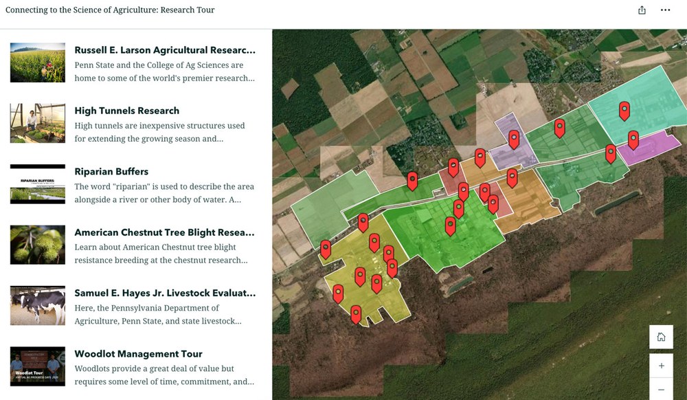
Virtual Research Farm Tour. Spending a few minutes navigating the map, virtual visitors can learn about pasture forage, riparian buffers, hydroponics systems, industrial hemp cultivation and much more!
This proposed project is modeled on the Virtual Research Tour created by Museum staff and student interns in 2019 and updated in 2020 and 2024. Online visitors learn about the latest research efforts across the 2,200 acre Russell E. Larson Agricultural Research Center. Interviews with scientists, graduate students, and partners have been curated by the Pasto Agricultural Museum using a StoryMap tool and with support from our colleagues in Penn State Extension and at Penn State University Libraries Maps Room.
Expected Outcomes
This project offers undergraduate student interns a unique experience in digital storytelling, combining historical and geographic data to present a compelling narrative of land use and history of agricultural science history at Penn State. The project is constructed to offer a systematic approach and clear objectives to yield a published work object for each intern's portfolio, while contributing to the digital exhibits offered by the Pasto Agricultural Museum.
A StoryMap will provide the framework to tell the comprehensive history of the Russell E Larson Agricultural Research Center and the personal stories of the previous landowners. Interactive maps showing the transformation of these farms into a leading agricultural research facility. An engaging narrative that combines historical research and spatial analysis for a rich, layered understanding of the land's legacy.
Timeframe
This project will target APD2025 for initial release, with additional narrative content added in subsequent Fall and Spring semesters. A full and complete StoryMap would be ready for APD 2026, coinciding with the United States Semi-quincentennial.
Illustrated Project Outline
Phase 1: Research and Data Collection
Landowner Research
Investigate the history of previous property owners, focusing on families' stories, farm operations, and land ownership. Collect data from primary sources, including archives, deeds, local historical societies. Create a model for sharing this historical narrative.
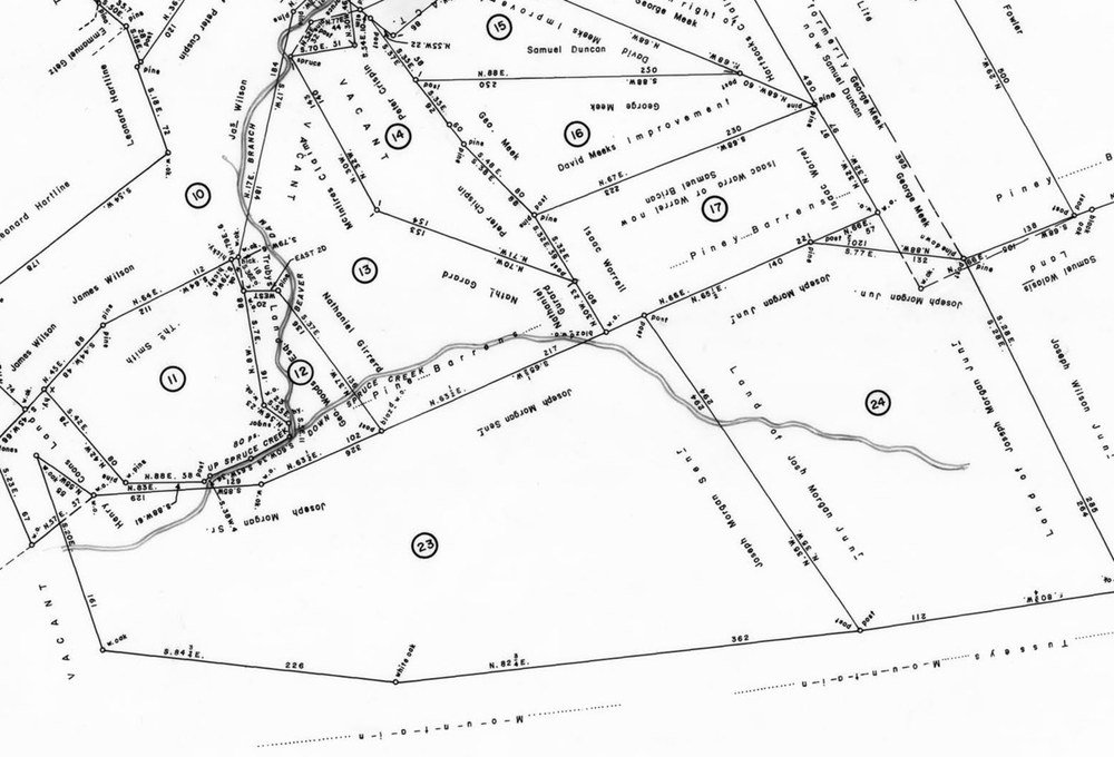
Map of original land warrants, from the Records of the Land Office, series #17.522, map #1436: 25 Tracts, Ferguson Township.
Center History
Gather materials on the development of the Russell E Larson Agricultural Research Center. Identify key milestones in the transformation of these private lands into a research facility.
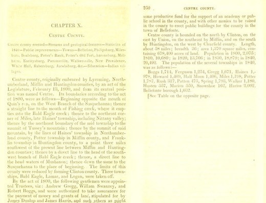
Israel Daniel Rupp's 1840 History and topography of Northumberland, Huntingdon, Mifflin, Centre, Union, Columbia, Juniata and Clinton counties.
Mapping Historical Farms
Obtain historical maps, land deed records, and any existing GIS data related to the original farms. Map the boundaries of the farms, identifying significant landmarks (homes, barns, fields, etc.). Collect spatial data on land use changes, such as where research plots or buildings now stand.
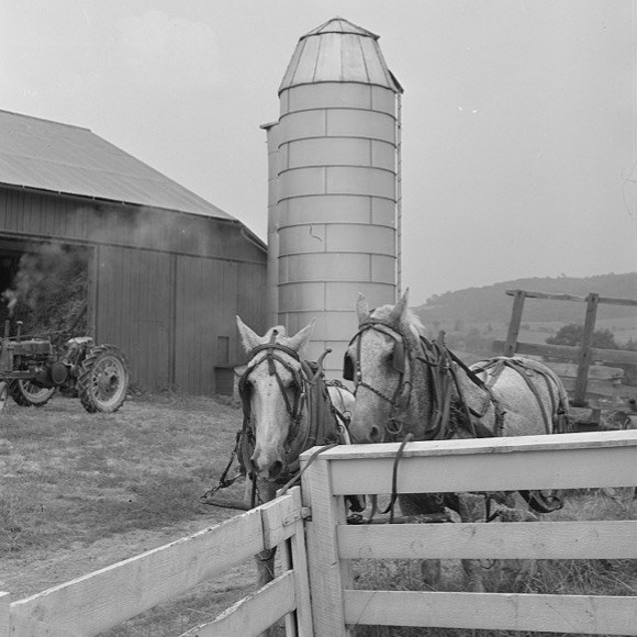
Farm horses and silo near Pine Grove Mills, Pennsylvania, Edwin Rosskam, photographer, July 1941. Source: Library of Congress.
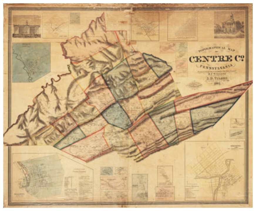
The earliest known map of Centre County, created by Henry Francis Walling and published by Samuel D. Tilden in 1861. The topographical map has been segmented by city/town and inset diagram. Source: Penn State Maps Library.
Land Use Research
Document the physical changes of the land (e.g., topography, agriculture practices, and infrastructure development).
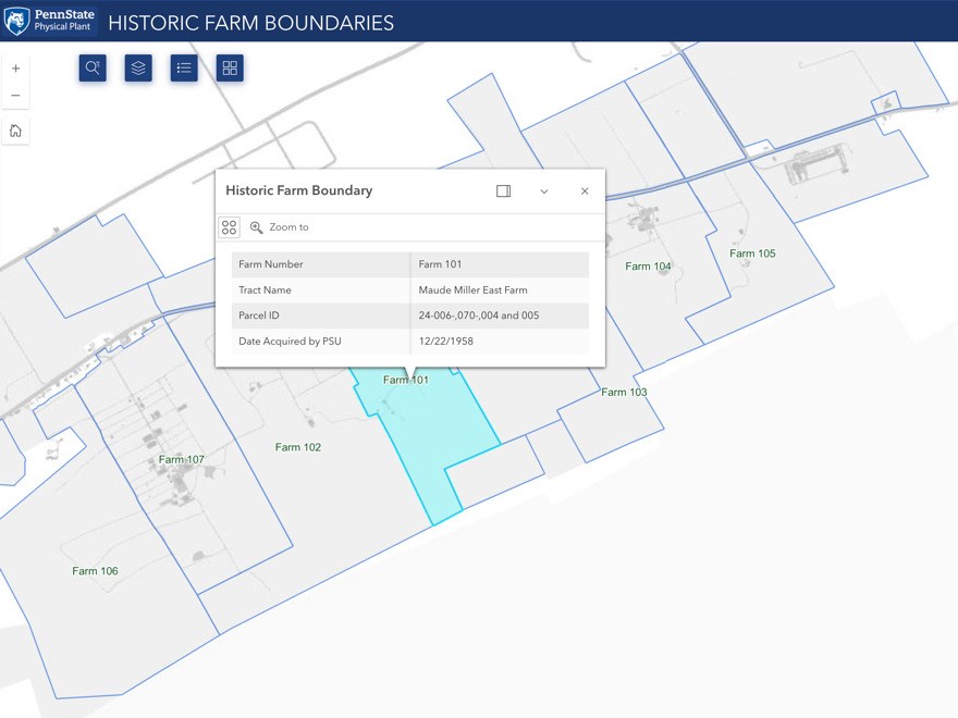
Historic Farm Boundaries. Source: Penn State Physical Plant Map Resources.
Collect aerial photos or satellite imagery to track how the research center has expanded over time. Identify current land uses at the site related to the research at each location: Agronomy Farm, Entomology Farm, Plant Pathology Farm, USDA, and PDA sites
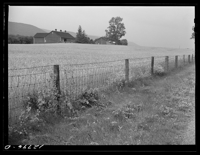
Wheat field near State College, Pennsylvania. Edwin Rosskam, photographer. June 1941. Source: Library of Congress.
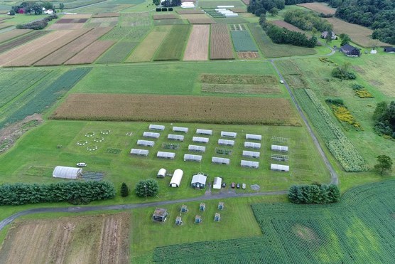
Entomology Farm at Rock Springs 2018. Source: Penn State.
Phase 2: Structure & Content Development
Outline Creation
Collaboratively plan the sections of the StoryMap. Each farm will have its own feature section, tied to its historical narrative and current state as part of the research center. Decide how to integrate text, images, maps, and multimedia into the StoryMap.
Layout, Text, and Media Collection
Design the StoryMap's flow: starting with an overview of the research center, followed by individual farm histories and then the overall land transformation. Organize photos, documents, and other media related to each farm and its owners for integration into the StoryMap.
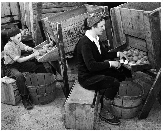
Millie Kepler and Johnnie Deibler cut seed potatoes for planting on Kepler's farm in Centre County, PA. Source: USDA Photo. 1943 USDA National Agricultural Library.
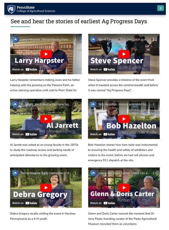
Pasto Agricultural Museum student interns video recorded, edited and produced "I Remember Ag Progress Days: an Oral History Project" in 2020.
Map Creation and Data Visualization.
Create interactive maps, showing historical boundaries alongside the current research center. Use layered maps to showcase changes in land use over time, linking spatial features to the history.
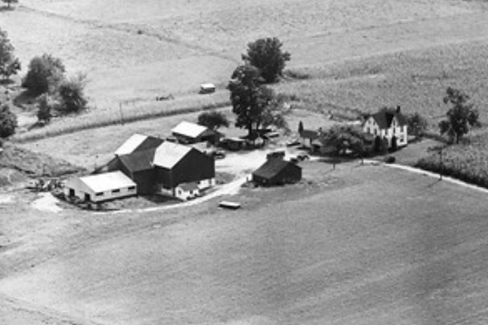
1967 aerial photograph of the Parson Farm. Source: Vintage Aerial, State Aerial Farm Statistics Collection, image 5697664, Film Roll 52.
Phase 3: Drafting and Review
Assemble the narrative, maps, and multimedia into the ArcGIS StoryMaps platform. Review the entire StoryMap for cohesiveness, accuracy, and functionality.Make revisions based on feedback from stakeholders, ensuring historical accuracy and user-friendly navigation.
Phase 4: Finalization and Presentation
Final Edits and Enhancements
Prepare the StoryMap for public viewing online and at the Pasto Agricultural Museum. Organize a presentation event for faculty, students, and stakeholders to showcase the final product.
Documentation
Document the research process and methods used to create the StoryMap. Provide a user guide for future updates or potential extensions of the StoryMap project.
About the Pasto Agricultural Museum
The Pasto Agricultural Museum explores the intersection of science and history with collections and exhibits focus tools and technology related to agricultural and rural life. Programming connects our agricultural past to the present day, often featuring the researchers and scientists who are addressing pressing issues for our food system and the environment.
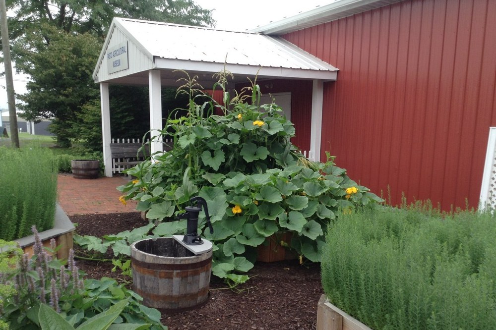
Entrance to the Pasto Agricultural Museum, the entry garden yields a bounty of corn, beans, and squash as part of a program to grow "Three Sisters" with partners at the Penn State Arboretum and Centre County Master Gardeners Demonstration Garden. Source: Penn State.
Pasto Agricultural Museum
- Email PastoAgMuseum@psu.edu
- Office 814-863-1383
Pasto Agricultural Museum
- Email PastoAgMuseum@psu.edu
- Office 814-863-1383

